Offered: August 8-9, 2020
Sold for $4,445 Original Historical Map of Nantucket Surveyed and Drawn by Reverend F.C. Ewer D.D., 1869, (Ferdinand Cartwright 1826-1883) mounted on canvas, unframed. 12 ¾ in. x 20 in. Provenance: Descended in the family of Captain James Cary, Master and half-owner of the Ship Rose.
More details [+]
Offered: August 8-9, 2020
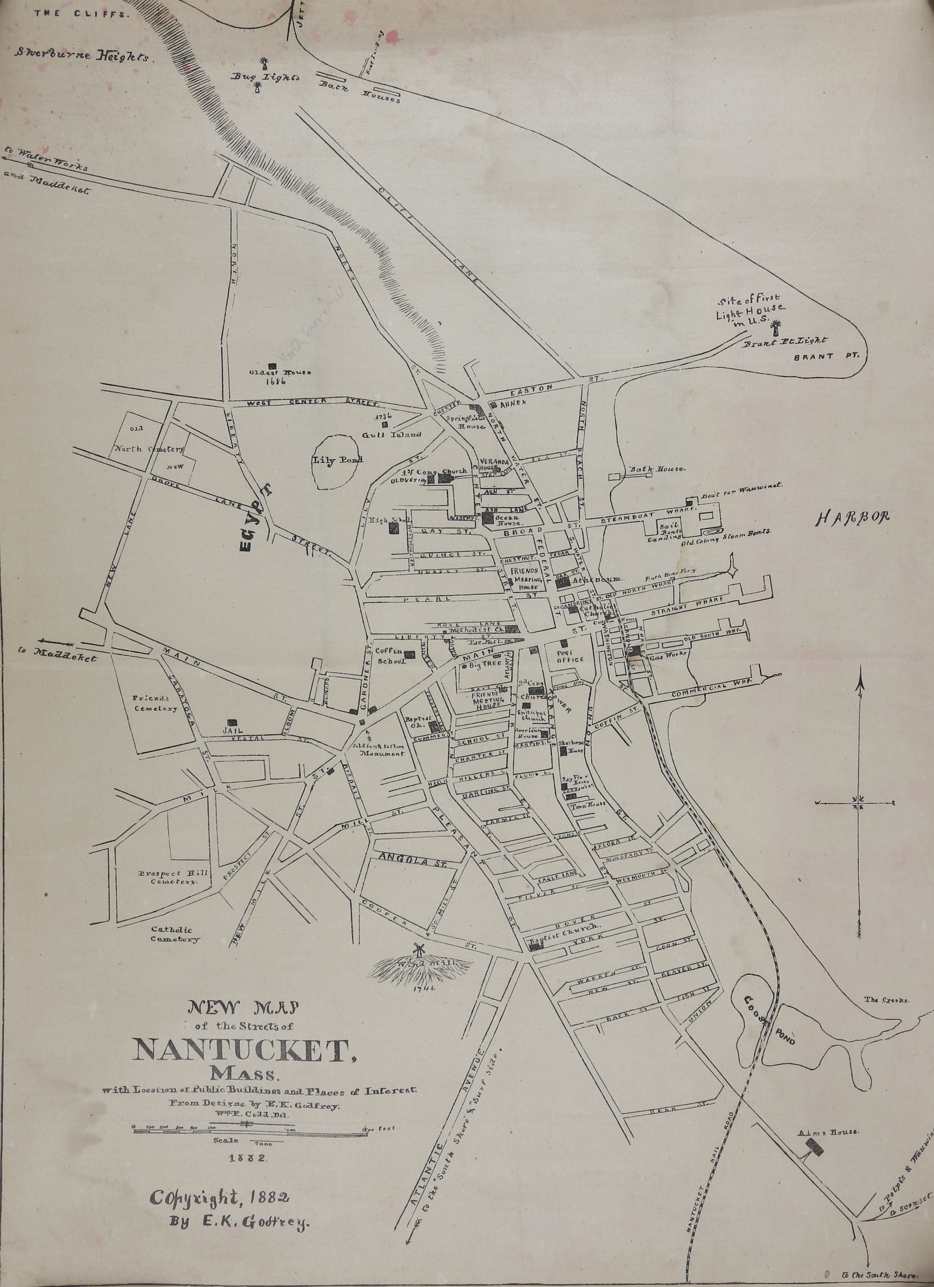
Sold for $1,905 Original Historical Map of Nantucket By E.K. Godfrey, 1882, “New Map of the Streets of Nantucket Mass.“, with Location of Public Buildings and Places of Interest, copyright, 1882 By E.K. Godfrey, unframed. 15 ¼ in. x 11 in. Provenance: Descended in the family of Captain James Cary, Master and half-owner of the Ship Rose.
More details [+]
Offered: August 8-9, 2020
Scarce 1888 Map of The Village of Siasconset on The Island of Nantucket, Mass, By Harry Platt. Copyrighted 1888. Published by E.T. Underhill & Co. New York. Canvas backed paper. 26 ¾ in. x 19 ¼ in. Provenance: Descended in the family of Captain James Cary, Master and half-owner of the Ship Rose.
More details [+]