
Please note that this auction has ended.
Click here for an overview of this auction.
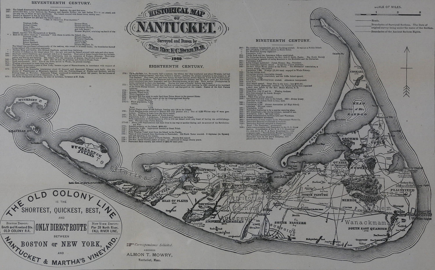
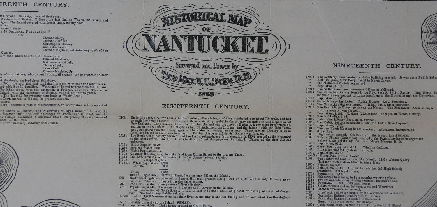
Historical Map of The Old Colony Line Surveyed and Drawn by the Reverend F.C. Ewer D.D., circa 1886


Please note that this auction has ended.
Click here for an overview of this auction.