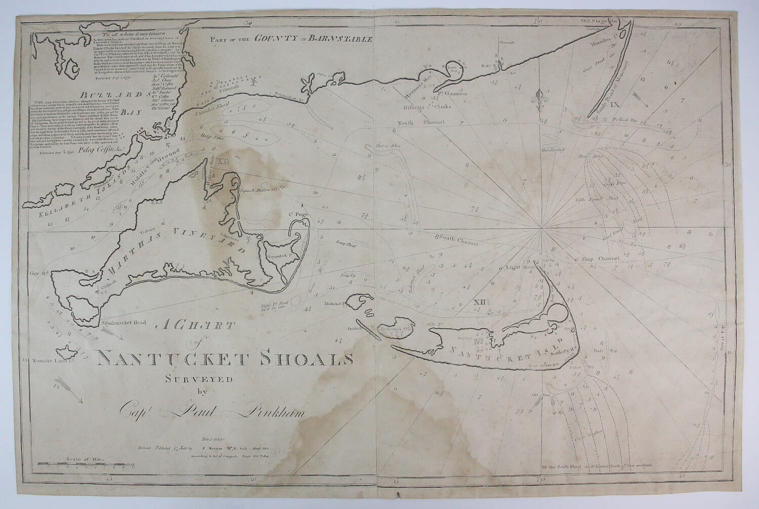
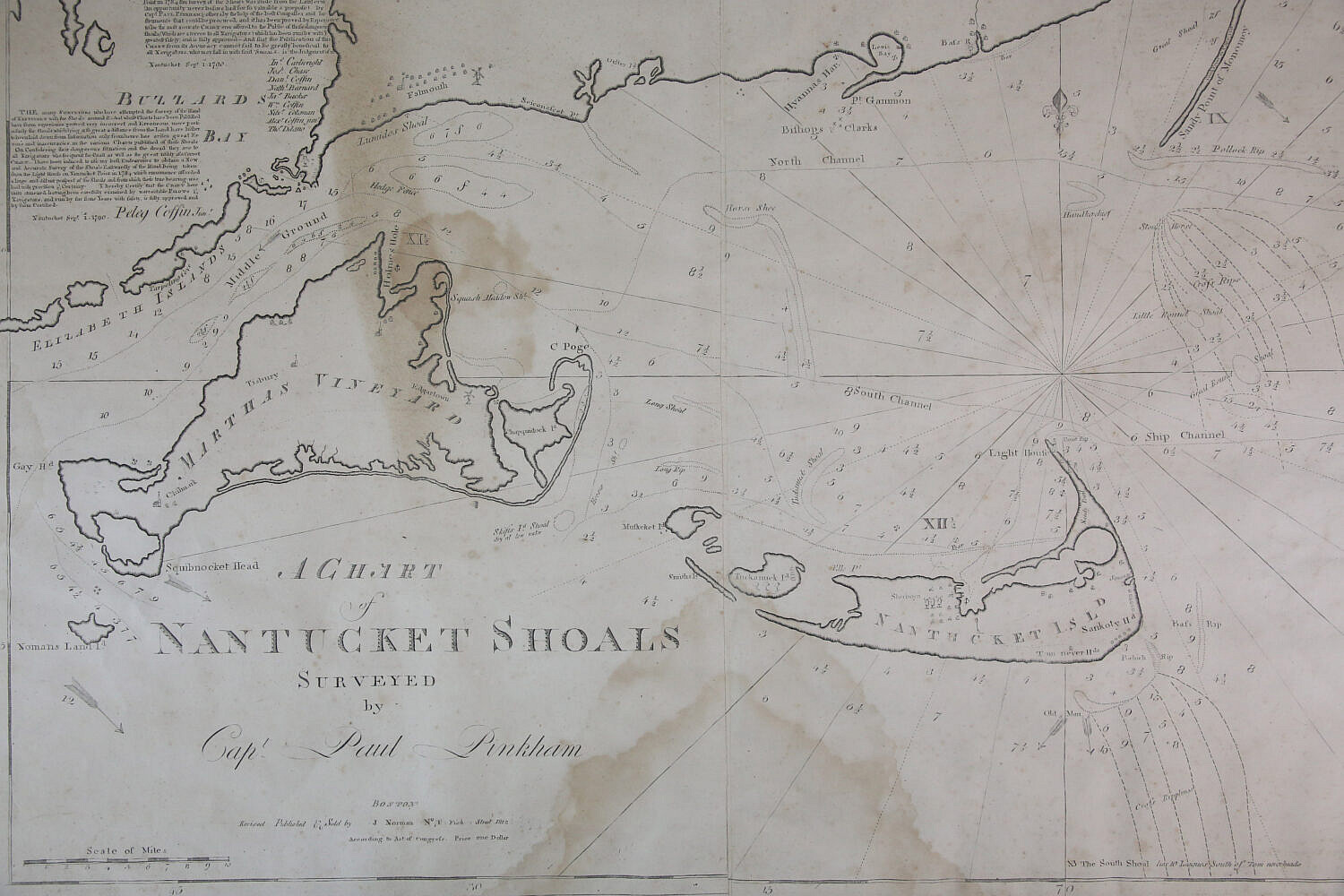
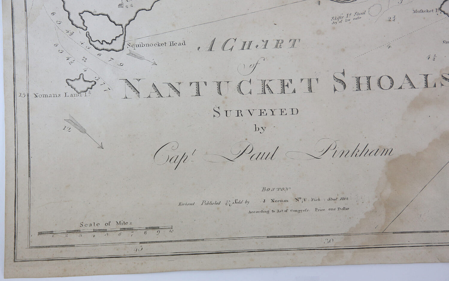
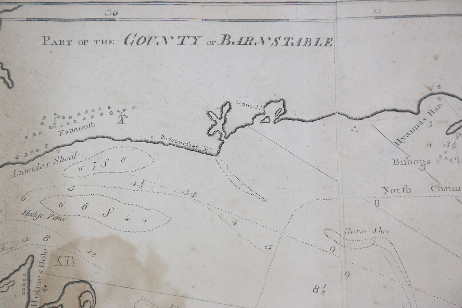
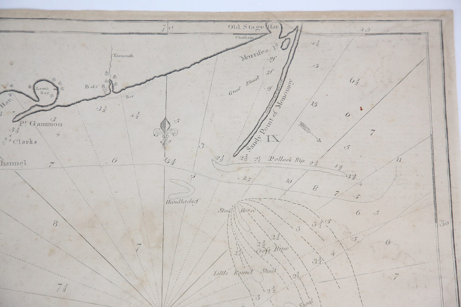
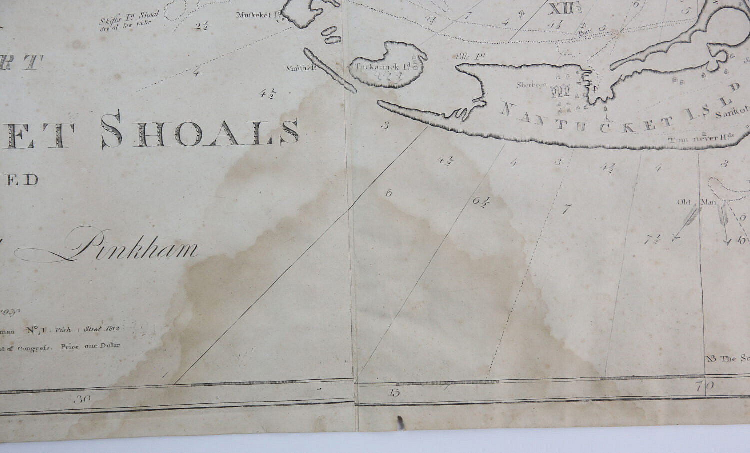
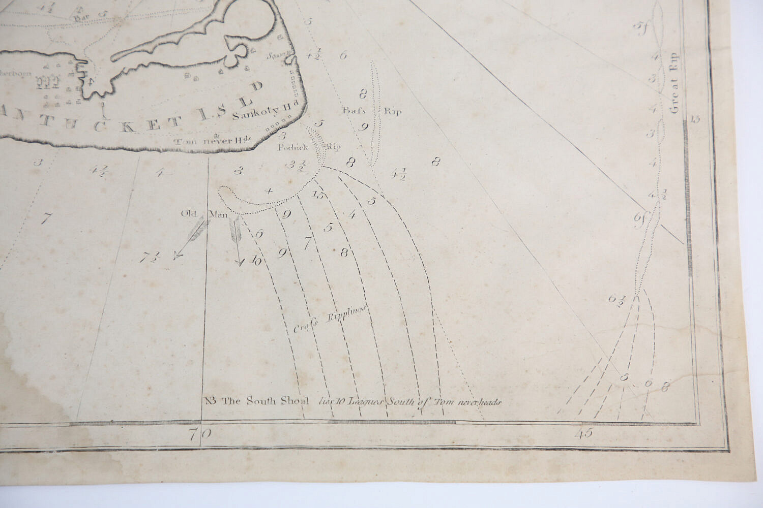
A Chart of Nantucket Shoals Surveyed by Capt. Paul Pinkham, Boston, Revised, Published and Sold by J. Norman No. 1 Fish Street 1812, According to Act of Congress. Price One Dollar; 4th state. The chart depicts the waters around Nantucket and Martha’s Vineyard, executed by Paul Pinkham, the first keeper of the new lighthouse at Nantucket’s Sandy Point, now known as Great Point. Captain Paul Pinkham (1736-1799) was a Nantucket Quaker, ex-whaleman and pilot.
20.75 in. x 31.25 in.
Please note that this auction has ended.
Click here for an overview of this auction.